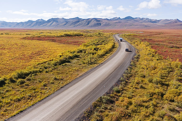
Length of Trip : It takes about 14 hours to finish the Dempster Highway, one-way.
Cost : Your biggest cost will be gas and vehicle maintenance! Rooms in the few accommodation options available are around the $200 a night range.
Best time to go : July and August. Spring and fall bring the colours, but it can get chilly, and are very short seasons. You can drive the highway in winter, although it requires extensive planning and specialty winter driving equipment.
Wheelchair friendly : No
Family friendly : Yes
Where to eat : There is a restaurant at Eagle Plains Motel and some options in Fort McPherson. Bring camping food and snacks. Be aware if you’re camping that you’re in Grizzly Bear neighborhood so make sure you don’t leave any food laying about.
Official Site : Click here to download the Yukon Government’s excellent travel guide for driving the Dawson Highway.
Where to Stay : There are no services on the tundra road except a small motel 21 miles from the Arctic Circle called the Eagles Plains Motel, and in the community of Fort McPherson. It’s worth calling ahead to make reservations since you don’t want to arrive and find everything is booked up! For information and reservations at Eagles Plains, telephone (867) 993-2453. Open year round, Eagles Plains also has a campground, restaurant and gas station. In Fort McPherson, contact the Peel River Inn, which can accommodate 16 guests in 8 rooms.
Getting There : Most visitors stock up in Dawson City and then head along the Klondike Highway, turning north onto the start of the Dempster Highway. Most driver conclude in Inuvik and turn back.
Note from Robin : Except for the first 5km, the highway is all gravel. Carrying one, or better yet two spare tires is highly recommended. Definitely learn how to change/fix tires, and some basic vehicle/bike maintenance. Set your odometer to zero and use the mileage/travelogue markers for navigation. Go slow and take your time. There’s no race to the Arctic Circle, and no medical services for 456 miles. Remember, once you reach as far north as you want to, you have to drive back to the Klondike Highway
 Overview
 Gallery
  Map
Map 
